Business Details
Your Trusted Land Surveyors in Melbourne
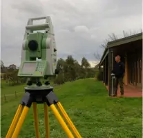
Meridian Land Surveyors P/L are consulting land surveyors based in Melbourne, delivering comprehensive surveying solutions across the metropolitan area. With over 25 years of industry experience, our principal surveyor is a Licensed Land Surveyor and a practicing member of the Association of Consulting Surveyors Victoria and The Institution of Surveyors Australia. We specialise in land development, cadastral, engineering, and specialist survey services, utilising advanced technology such as Leica SmartStation and AutoCAD to provide tailored solutions.Our client-focused approach ensures timely, reliable service for industries including construction, architecture, and engineering design. Registered with Land Victoria's SPEAR system, we streamline subdivision processes and administrative requirements, allowing clients to focus on project compliance. Our commitment to accuracy, high-quality deliverables, and personalised attention has established us as a trusted partner in the surveying sector.
Services
Land Development Surveys
Cadastral Surveys
Engineering Surveys
Subdivision & Consolidation
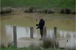
Flood Level Surveys
Digital Feature Surveys
Easement Dealings
Lease Plans
Lettable Area Surveys
Plan of Subdivision
Highlights and features
- Our principal surveyor has over 25 years of industry experience.
- We utilise advanced technology like Leica SmartStation and AutoCAD.
- Registered with Land Victoria's SPEAR system for efficient processing.
- Client-focused approach ensures timely and reliable service delivery.
- Specialise in navigating complex council and regulatory requirements.
Associations and certifications
- Association of Consulting Surveyors Victoria
- The Institution of Surveyors Australia
Services
Subdivision Surveys
We prepare detailed subdivision plans adhering to council regulations, handling lodgement and coordination with authorities. Our services include boundary re-establishment, easement creation, and compliance documentation. Clients benefit from streamlined processes and expert navigation of complex planning requirements.
Cadastral Surveys
Our cadastral surveys re-establish property boundaries and legal dimensions using precise measurements. This service supports land transactions, dispute resolution, and development planning. Clients receive accurate, legally compliant documentation for title registration and land management.
Engineering Surveys
Engineering surveys provide topographic data and site analysis for infrastructure projects. We deliver digital feature, level, and contour surveys to support construction and design. Clients gain reliable data for project planning and implementation.
Digital Feature Surveys
Using advanced equipment, we create detailed digital maps of site features and elevations. This service aids in flood level analysis, site context assessments, and development planning. Clients receive high-resolution data for accurate design and compliance purposes.
Easement Dealings
We manage the creation and modification of easements and legal access rights. Our services include plan preparation, council submissions, and compliance documentation. Clients benefit from clear legal frameworks and efficient processing for property modifications.
Questions
What surveying services do you offer?
We provide subdivision, cadastral, engineering, digital feature, and easement surveys, along with flood level and site context assessments.
Do you operate outside Melbourne?
Our primary service area is Melbourne's metropolitan region, covering council jurisdictions and development zones.
How do you handle subdivision processes?
We prepare plans, liaise with councils, and manage lodgement through Land Victoria's SPEAR system for efficient approvals.
What technology do you use?
We utilise Leica SmartStation and AutoCAD for precise measurements and tailored digital solutions.
Are you registered with industry bodies?
Yes, we are members of the Association of Consulting Surveyors Victoria and The Institution of Surveyors Australia.