Business Details
31 Years
experience
Expert Land Surveying Services in Melbourne, Victoria
Established in 1995, Wayne Mitchell Surveying has been delivering precision surveying and mapping services to Victorian industries for over 25 years. As licensed land surveyors based in Melbourne, we combine extensive field experience with cutting-edge technology, including robotic total stations, GPS systems, and advanced CAD software. Our expertise spans pipeline surveys, dam assessments, water industry projects, and vineyard mapping, serving councils, engineers, and government agencies. We prioritise client satisfaction through cost-effective solutions and high-quality deliverables tailored to project specifications. Our team's technical proficiency and commitment to innovation have solidified our reputation as a trusted partner in Victoria's surveying sector.From asset recording to construction control, we deliver accurate geospatial data across diverse terrains. Our work on major infrastructure projects, such as the Macedon Sewerage Scheme, demonstrates our capability to handle complex, large-scale assignments. We maintain rigorous quality standards while adapting to evolving industry practices. Our client-centric approach ensures clear communication and reliable outcomes, whether for subdivision surveys or as-constructed documentation. With a focus on precision and reliability, we continue to support Victoria's development needs through comprehensive surveying solutions.
Services
Asset Recording
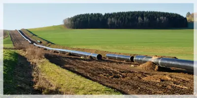
Pipeline Surveying
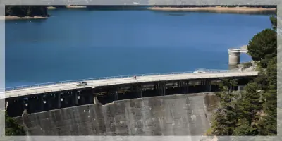
Dam Surveying
Water Industry Surveys
Vineyard Surveying
Construction Surveys
Subdivision Mapping
Geographic Asset Tracking
Details
- Year established: 1995
Highlights and features
- We have over 25 years of experience in Victorian land surveying projects.
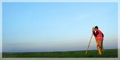
- We utilise robotic total station technology, GPS and advanced CAD systems.
- We produce survey plans to exact client specifications using modern software.
- Our team specialises in complex infrastructure projects like sewerage schemes.
- We implement cost-effective surveying solutions without compromising quality.
Services
Asset Recording
Our asset recording service captures geographic locations of infrastructure assets using advanced surveying technology. We document manholes, power poles, dams, bridges and pipelines across any land size. This comprehensive mapping solution provides clients with accurate spatial data for maintenance, planning and regulatory compliance purposes.
Pipeline Surveying
We specialise in detailed pipeline surveys for sewerage schemes and utility networks. Our services include construction set-out, as-constructed documentation and 33km sewer reticulation mapping. Using GPS and total station technology, we ensure precise alignment and dimensional accuracy for both underground and surface pipeline systems.
Dam Surveying
Our dam surveying expertise covers topographic mapping and structural documentation for water authorities. We provide detailed elevation data, capacity calculations and construction monitoring to ensure compliance with safety standards. Our surveys support both new dam construction and maintenance of existing infrastructure.
Water Industry Surveys
We deliver comprehensive surveying solutions for water infrastructure projects. Our services include sewerage scheme mapping, pipeline reticulation documentation and water treatment facility surveys. Using robotic total stations and GPS systems, we produce detailed plans that meet the specific requirements of water authorities and engineering consultants.
Vineyard Surveying
Our vineyard surveying service provides precise land mapping for viticulture operations. We create detailed topographic plans that help optimise vineyard layout and irrigation systems. These surveys support land development applications and long-term agricultural planning while maintaining strict accuracy standards.
Questions
What surveying services do you specialise in?
We specialise in asset recording, pipeline surveying, dam assessments, water industry projects, and vineyard mapping using advanced geospatial technology.
Which areas do you service?
While based in Melbourne, we provide surveying services across Victoria for both urban infrastructure and rural development projects.
What technology do you use?
We utilise robotic total stations, GPS systems, and modern CAD software to ensure precise data collection and accurate plan production.
How experienced are your surveyors?
Our team has over 25 years' experience in Victorian land surveying, with expertise in complex infrastructure projects like sewerage schemes and water treatment facilities.
Can you handle large-scale projects?
Yes, we've successfully completed major assignments including 33km sewer reticulation mapping and 12km sewer rising main documentation projects.
How do you ensure quality results?
We maintain strict quality standards through advanced equipment calibration, experienced personnel, and rigorous data verification processes for all survey deliverables.