Business Details
Trusted Surveying Services in Perth, Western Australia
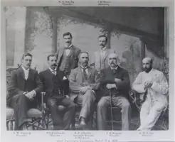
Established in 1868, we are the oldest surveying company in Western Australia. Our heritage traces back to Alexander Forrest, with the company name derived from Charles Crossland and Henry Hardy, who joined in the late 1800s. We deliver value-for-money surveying solutions across construction, land development, and railway sectors, combining over 150 years of expertise with cutting-edge technology. Our team of licensed professionals prioritises safety, precision, and client satisfaction, serving both government and private clients. We are approved suppliers to the Western Australia Department of Planning, Lands and Heritage and the Public Transport Authority.Our portfolio includes landmark projects such as the Northbridge Tunnel extension, Carramar Golf Course Estate subdivisions, and rail infrastructure upgrades. We maintain rigorous safety protocols to protect employees and stakeholders. Our directors bring decades of experience in subdivisions, engineering surveys, and project management, supported by industry accolades. We specialise in adapting to evolving legislative requirements while providing tailored advice for residential, commercial, and large-scale developments. Our commitment to innovation ensures clients receive accurate, timely, and cost-effective spatial solutions.
Services
Railway Surveys
Land Subdivisions
Boundary Re-Establishment
UAV Mapping
Laser Scanning
Construction Set-Out
Strata Conversions
Underground Mapping
Monitoring Surveys
Feature Surveys
Highlights and features
- We have over 150 years of surveying experience in Western Australia
- We utilise advanced technology including UAV mapping and laser scanning
- Our team includes award-winning licensed surveyors with civil construction expertise
- We deliver projects safely, on time, and within budget
- We are approved suppliers to WA government transport and land authorities
Associations and certifications
- Australian Standards AS 5488.2:2022
- Western Australia Department of Planning, Lands and Heritage
- Public Transport Authority
What people say
Efficient and effective
Expediency, professionalism
Accurately and efficiently
Diligent team
Timely service
Services
Railway Surveys
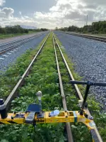
Specialist surveying for railway projects including alignment control, tamping support, and as-constructed reporting. We provide digital geometry files for construction and renewal projects across metro and remote Western Australia. Our team leverages 20+ years of rail industry experience and Trimble Gedo Vorsys technology.
Land Subdivisions
Comprehensive subdivision services from initial design to final title issuance. We handle green title, strata, and survey-strata projects including boundary re-establishment, WAPC applications, and large-scale developments. Our expertise covers residential, commercial, and government land divisions with legislative compliance.
UAV Mapping
Aerial mapping using CASA-approved drones for 3D data and imagery. We deliver bulk earthworks quantities, feasibility planning, and progress reporting with high-resolution point clouds and digital terrain models. Services cover Wheatbelt, Pilbara, and metropolitan areas.
Laser Scanning
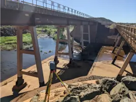
High-accuracy 3D data capture for structural planning and as-built documentation. We produce detailed point clouds and models for complex infrastructure, enabling precise fabrication and design. Applications include inaccessible structures and safety-critical environments.
Boundary Surveys
Licensed boundary re-establishment services to prevent encroachments. We provide legally certified plans for construction, fencing, and council approvals. Our surveys include physical marking, digital documentation, and neighbour notifications as required.
People
Cameron Macliver
Licensed Surveyor
Licensed Surveyor with 25+ years experience in subdivisions and construction. Recipient of Malcolm Evensen Prize and Sydney John Stokes Award for surveying excellence. Joined Crossland & Hardy in 1996 from civil construction background.
Matthew Pyke
Survey Department Manager
Over 25 years managing engineering surveys and railway projects. Expert in field operations, project timelines, and problem-solving for subdivisions and infrastructure developments. Joined the company in 1996.
Daniel Macey
Licensed Surveyor
Licensed professional managing diverse engineering and cadastral projects. Specialises in updating skill sets for modern surveying challenges. Joined Crossland & Hardy in 2010 with expertise in project management.
Questions
What surveying services do you offer?
We provide railway surveys, land subdivisions, UAV mapping, laser scanning, boundary re-establishment, and construction set-out services across Western Australia.
How long have you been in business?
We've been operating since 1868, making us Western Australia's oldest surveying company with 150+ years of continuous service.
Do you work on government projects?
Yes, we're approved suppliers to the WA Department of Planning, Lands and Heritage and Public Transport Authority for survey services.
What technology do you use?
We utilise UAV drones, laser scanning, Trimble Gedo Vorsys trolley systems, and digital terrain modelling software for modern surveying solutions.
Can you handle large-scale developments?
Yes, our experience includes subdivisions of 3000+ lots, high-rise developments, and major infrastructure projects across regional WA.