
Business Details
29 Years
experience
Your Trusted Partner for Land Surveying Solutions
Established in 1997, Land Surveys has grown into one of Australia's leading geospatial companies, with over 400 professional staff and offices across Australia and Papua New Guinea. Our expertise spans aerial, engineering, and hydrographic surveys, land development, laser scanning, mining services, and specialist digital engineering solutions. With 26 years of experience on major projects, we combine cutting-edge technology with deep industry knowledge to deliver precise surveying outcomes. Our team's commitment to innovation and client collaboration has made us a trusted partner for complex infrastructure, construction, and environmental projects.We maintain strict compliance with Australian standards while providing scalable solutions tailored to each client's unique requirements. Our investment in advanced equipment and cloud-based data management systems ensures efficient, accurate deliverables across all surveying disciplines. Backed by long-term industry relationships and a focus on staff development, we consistently deliver risk-mitigated solutions that meet evolving market demands.


Services
Engineering Surveys
Dilapidation Services
Hydrographic Surveys
Land Development
Digital Engineering
Mining Surveying
Monitoring Services
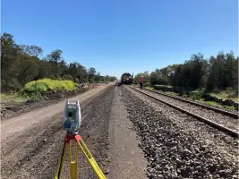
Rail Surveys
Reality Capture
Utility Mapping
Details
- Year established: 1997
Highlights and features
- 26 years of specialist surveying experience on Australia's largest infrastructure projects
- Nationwide network with 7+ offices and 400+ qualified professionals
- Advanced 3D reality capture and cloud-based data management systems
- Proven track record with major clients in construction and resources sectors
- Compliance-focused approach meeting Australian Standard 4349.0-2007 requirements
What people say
Best scanning teams
Pragmatic professional approach
Quality of data amazing
Exceeded expectations
Cost-effective solutions
Services
Engineering Surveys
Our engineering surveys provide precise spatial data for infrastructure projects including roads, railways, and buildings. Using advanced measurement systems, we ensure compliance with Australian standards throughout project lifecycles. Our team delivers dimensional control and structural verification services that maintain construction accuracy from concept to completion.
Dilapidation Services
We conduct comprehensive dilapidation surveys documenting building conditions using 3D reality capture and high-resolution imaging. Our reports identify cracks, distortions, and structural defects with timestamped evidence for legal protection. Services include pre-construction baselines, lease documentation, and infrastructure condition monitoring across residential and commercial sectors.
Hydrographic Surveys
Our hydrographic surveys map underwater topographies using multibeam echo sounders and sub-bottom profilers. We deliver bathymetric data for port developments, dredging operations, and environmental assessments. Advanced geophysical sensors provide seabed composition analysis and sedimentation measurements to support marine construction and resource management.
Digital Engineering
We transform geospatial data into actionable insights through GIS integration and BIM management. Our cloud-based DMaaS platform enables real-time data analytics and visualisation for infrastructure projects. Services include 3D modelling, topographic analysis, and digital twin creation to optimise asset management and decision-making processes.
Land Development
Our land surveyors provide boundary determination, subdivision planning, and development approvals assistance. We support residential, commercial, and industrial projects with topographic surveys and strata titling services. Expert guidance through regulatory processes ensures compliance with local planning requirements and efficient project delivery.
People
Peter Rullo
Executive Director
Founder of Land Surveys in 1997 with 30+ years surveying experience. Holds Bachelor of Surveying from Curtin University and multiple industry accreditations. Recognised leader in geospatial innovation and indigenous engagement.
Ben Westaway
Chief Operating Officer
Qualified surveyor and mining engineer with 20+ years leadership experience. Former managing director of survey firms, specialising in operational management and technical implementation across diverse projects.
Paul Linton
Executive General Manager
Registered surveyor in NSW, QLD, and NT with engineering honours degree. Combines technical expertise with project management skills across major infrastructure developments and spatial information systems.
Alan Macpherson
General Manager WA
15-year surveying veteran with expertise in structural, civil, and land surveying projects across Western Australia. Specialises in delivering precise measurement solutions for complex construction requirements.
Jason Armitage
General Manager PNG
25+ years industry experience focusing on resources sector projects. Previously Operations Manager, now expanding Land Surveys' presence in Papua New Guinea with specialist infrastructure surveying capabilities.
Questions
What surveying services does Land Surveys offer?
We provide engineering surveys, dilapidation assessments, hydrographic mapping, land development, digital engineering, mining surveying, and utility mapping services across Australia and PNG.
How experienced is Land Surveys?
With 26 years of industry experience since 1997, we've completed thousands of projects including major infrastructure like Forrestfield Airport Link and Sydney Metro.
Which regions does Land Surveys operate in?
We operate nationwide from offices in Perth, Brisbane, Sydney, Melbourne, Darwin, and Port Moresby, serving both urban and remote locations.
What technology does Land Surveys use?
We utilise 3D laser scanning, UAV aerial mapping, cloud-based data management, and BIM integration to deliver precise digital engineering solutions.
How are dilapidation reports conducted?
Our specialists use high-resolution imaging, 3D reality capture, and georeferenced point clouds to document building conditions with on-site report generation.
What industries does Land Surveys support?
We serve construction, mining, infrastructure, environmental, and property sectors with tailored surveying solutions for residential, commercial, and industrial projects.
Videos