
Business Details
11 Years
experience
Expert Land Surveying Services in Ocean Grove
Established in 2015 by Director Lachlan Macrae & Co & Co, our firm delivers precision and expertise in land surveying across Geelong and surrounding regions. With decades of combined experience, we specialise in subdivision planning, boundary re-establishment, and construction set-out surveys tailored to residential, commercial, and rural projects. Our team of licensed professionals adheres to rigorous quality standards while maintaining clear communication to ensure client projects progress seamlessly.We prioritise local council compliance knowledge and technological innovation to address complex surveying challenges. Our reputation for thoroughness and client-focused solutions has positioned us as trusted advisors for property developers, architects, and landowners navigating subdivision processes.
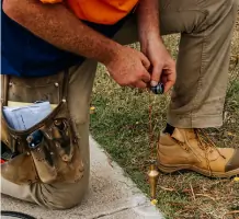
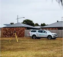

Services
Subdivision Planning
Title Re-establishment
Feature Surveys
Set-Out Surveys
Boundary Re-alignments
Residential Subdivisions
Commercial Subdivisions
Rural Subdivisions
Estate Developments
Application Surveys
Details
- Year established: 2015
Highlights and features
- Our team consists of licensed surveyors with decades of combined experience.
- We exceed Victorian surveying standards through rigorous internal procedures.
- We provide clear communication to ensure smooth project execution.
- Our local knowledge ensures efficient council compliance for Geelong projects.
- We offer tailored solutions for both residential and commercial land development.
What people say
Expert knowledge of council requirements
Guided through complex subdivision process
Accurate survey results
Reliable project management
Highly recommend
Services
Subdivision Planning
We prepare legal subdivision plans for residential, commercial, and rural properties. Our licensed surveyors ensure compliance with council regulations and manage documentation for Land Victoria registration. Services include feasibility assessments, boundary adjustments, and multi-storey development planning.
Title Re-establishment
Our team locates and verifies property boundaries using historical records and field measurements. This service resolves disputes, supports fence installations, and addresses adverse possession claims through precise surveying and documentation for legal applications.
Feature Surveys
We create detailed site condition maps showing topographical features and levels. These surveys support architectural design, infrastructure projects, and council permit applications by providing accurate existing condition data in digital formats.
Set-Out Surveys
We translate architectural designs into physical markers for construction projects. Our surveyors accurately position building footprints and infrastructure elements for residential units, commercial buildings, and industrial developments using client-supplied data.
Application Surveys
We prepare survey documentation for legal title adjustments under the Transfer of Land Act. This includes Section 60 adverse possession applications, boundary correction plans, and field records required for Land Victoria submissions.
People
Lachlan Macrae
Director & Licensed Surveyor
With nearly two decades of experience, Lachlan leads our surveying team. He specialises in complex boundary issues and subdivision procedures, having worked on major infrastructure projects and residential developments.
Riley de Vries
Project Surveyor
Riley joined Macrae & Co & Co after completing his surveying degree in 2019. He now manages field surveys and plan preparation while completing his professional training agreement to become a licensed surveyor.
Questions
Our title boundary is being disputed. Can you help?
Yes, we resolve boundary disputes by accurately positioning title boundaries with physical markers and detailed plans that align with fencing and legal records.
How much will my subdivision cost?
Costs depend on lot numbers, property size, and council requirements. We provide fixed-price quotations after assessing your specific project details.
What are the subdivision process steps?
The process includes feasibility assessment, planning permits, survey documentation, council approvals, and final plan registration with Land Victoria.
Why do I need a licensed surveyor?
Licensed surveyors ensure legal compliance for property transactions, developments, and subdivisions by providing accurate boundary determinations and council-approved documentation.
Can I subdivide my land?
Subdivision eligibility depends on local planning schemes. We assess your property's potential and guide you through council requirements for legal subdivision.