
Business Details
Your Trusted Land Surveying Partner in Mildura
Mildura Survey Solutions are licensed land surveyors dedicated to delivering high-quality surveying solutions across Victoria and New South Wales. With a focus on professional and timely service, we specialise in land development projects ranging from subdivisions to construction surveys. Our team utilises state-of-the-art equipment to ensure precision and reliability for every client. Operating from the Sunraysia region, we extend our services to areas including Swanhill, Broken Hill, and Balranald. Whether you require boundary surveys, easement adjustments, or engineering setouts, our expertise supports residential, commercial, and industrial developments.We prioritise clear communication and technical excellence to meet project requirements efficiently. Our licensed professionals are equipped to handle complex challenges, ensuring compliance with regulatory standards. By combining advanced technology with local knowledge, we deliver tailored solutions for diverse surveying needs. Contact us to initiate your next development project with confidence in our capabilities.
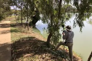
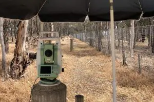
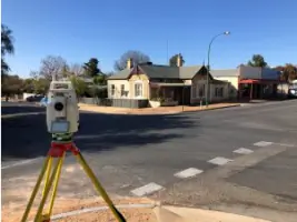
Services
Subdivisions & Consolidations
Title Re-establishment
Feature & Level Surveys
Creation & Removal of Easements
Engineering & Construction Surveys
Application Surveys
Highlights and features
- We are licensed surveyors operating in Victoria and NSW with regional expertise.
- Our team utilises state-of-the-art surveying equipment and software.
- We handle projects from small subdivisions to complex multi-stage developments.
- Services span residential, commercial, and industrial land development needs.
- We provide clear guidance through every stage of the surveying process.
Services
Subdivisions & Consolidations
We specialise in subdividing land, from simple two-lot divisions to complex multi-stage projects. Our team guides clients through regulatory processes and documentation. Utilising advanced technology ensures precise boundary definitions and compliance with local planning requirements.
Title Re-establishment
Our title re-establishment surveys determine accurate boundary positions for fencing or property occupation. We use high-precision equipment to resolve disputes and ensure legal compliance. This service supports informed decisions for property development or transactions.
Feature & Level Surveys
Feature and level surveys provide detailed site data for residential, commercial, and industrial design projects. We map terrain, structures, and utilities to support engineering and architectural plans. Accurate elevation data ensures effective project planning and execution.
Engineering & Construction Surveys
We deliver construction setouts, control surveys, and as-constructed verification for infrastructure projects. Our work ensures alignment with design specifications and regulatory standards. Precision in every phase supports efficient project delivery and quality outcomes.
Application Surveys
Our application surveys prepare documentation for legal processes like adverse possession claims. We ensure data accuracy and compliance with jurisdictional requirements. This service supports successful submissions for property rights adjustments and boundary disputes.
Questions
What surveying services do you offer?
We provide subdivisions, title re-establishment, feature surveys, easement adjustments, construction setouts, and legal application surveys for residential, commercial, and industrial projects.
Which areas do you service?
We operate across Victoria and New South Wales, including Mildura, Swanhill, Broken Hill, Balranald, and surrounding regions.
How do you ensure survey accuracy?
We use state-of-the-art equipment and software to guarantee precise measurements and compliance with regulatory standards for every project.
Can you assist with complex subdivision projects?
Yes, we handle projects from small subdivisions to multi-stage developments, guiding clients through planning, documentation, and execution.