Business Details
Professional Land Surveying Services in South Australia
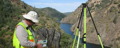
Bleeze Neale & Associates Pty Ltd is a South Australian land surveying consultancy with 30 years of experience delivering precise surveying solutions. Our team serves private, corporate, local government, and state government clients using advanced robotic and GPS instrumentation alongside industry-leading software for digital file production. We specialise in boundary identification, land division, engineering surveys, lease plans, and easement management, providing end-to-end support from project conceptualisation to certification by licensed surveyors.Our expertise spans residential developments to large-scale infrastructure projects, ensuring compliance with Lands Titles Office requirements and client-specific needs. With offices in Gawler and Morphett Vale, we combine technical excellence with local knowledge to deliver accurate, legally certified surveying outcomes for property and engineering projects across South Australia.
Services
Boundary Surveys
Land Division
Engineering Surveys
Lease Plans
Easement Management
Construction Set-Out
Development Applications
Highlights and features
- We offer 30 years of land surveying expertise in South Australia
- Our team uses advanced robotic and GPS instrumentation for accuracy
- We serve private, corporate, and government clients across all project scales
- Our surveyors provide certified plans compliant with Lands Titles Office requirements
- We deliver end-to-end project support from conceptualisation to certification
Services
Boundary/Identification Survey
Our boundary surveys clarify property lines using official Lands Titles Office records and on-site measurements. We mark boundaries, prepare certified plans, and identify encroachments for building projects, fencing, or property disputes. This service ensures legal compliance and prevents development conflicts through precise robotic and GPS technology.
Land Division Survey
We facilitate land division projects from minor boundary adjustments to large-scale subdivisions. Our process includes feasibility analysis, agency approvals, and title issuance. With experience in complex developments, we handle all stages from initial investigation to final certification, ensuring compliance with local regulations and infrastructure requirements for residential and commercial developments.
Engineering/Detail Surveys
Our engineering surveys provide detailed topographic data for construction projects. Using digital contour mapping and feature analysis, we create precise site models for residential buildings, shopping centres, and road infrastructure. This service includes underground service detection and boundary overlays to support accurate design and construction planning across South Australia.
Easement Survey
We prepare easement plans for infrastructure, party walls, and access rights. Our surveys document underground and above-ground easements, ensuring legal compliance through Lands Titles Office certification. This service supports property development by clarifying usage rights and facilitating utility installations while maintaining accurate title documentation for residential and commercial properties.
Construction Set-Out
Our construction set-out service translates design plans into physical site markers using precision instruments. We establish reference points for buildings, roads, and infrastructure projects, ensuring alignment with approved plans. This service supports accurate construction execution through digital data integration and on-site verification, reducing errors and rework during development projects across South Australia.
Questions
What surveying services do you offer?
We provide boundary surveys, land division, engineering surveys, easement management, lease plans, construction set-out, and development application support for residential, commercial, and government projects.
How do you handle property boundary disputes?
We conduct identification surveys using Lands Titles Office records and on-site measurements to legally certify boundary positions, helping resolve disputes through accurate documentation and certified plans.
Can you assist with large-scale subdivisions?
Yes, we manage all stages of major land divisions including feasibility analysis, agency approvals, and title issuance, leveraging 30 years of experience in complex subdivision projects.
What technology do you use?
We utilise robotic total stations, GPS instrumentation, and advanced CAD software to ensure survey accuracy and produce digital deliverables meeting client and regulatory requirements.
Do you work with government clients?
Yes, we provide surveying services for local and state government projects, including infrastructure development, planning applications, and public land management requirements across South Australia.
How are easements documented?
We prepare certified easement plans showing underground and above-ground rights, ensuring compliance with Lands Titles Office requirements for creation, variation, or extinguishment of easements.