Business Details
50+ Years
experience
Professional Surveyors in Geraldton
Established in 1956, Hille, Thompson and Delfos has built a reputation as a leading surveying and town planning practice in Western Australia. Our team of licensed, engineering, and mine surveyors utilises cutting-edge technology including GPS, UAVs, and 3D laser scanning to deliver precise solutions across diverse projects. With ISO 9001:2015 and ISO 45001:2018 accreditations, we maintain rigorous quality and safety standards while serving clients from Geraldton to Newman. Our expertise spans cadastral surveying, engineering works, mining operations, and subdivision design, supported by 13 staff and contract professionals.We prioritise ethical practices, project integrity, and client collaboration, ensuring compliance with statutory requirements and timely delivery. Our digital infrastructure and GIS database management further enhance our capacity to support large-scale developments. With decades of collective experience, we remain committed to advancing surveying science while addressing the evolving needs of government, industry, and private clients across regional Western Australia.
Services
Cadastral Surveying
Engineering Surveying
Mining Surveying
Town Planning
Aerial Photography
Details
- Year established: 1956
Highlights and features
- We have 65+ years of combined surveying experience since 1956.
- Our ISO 9001:2015 and ISO 45001:2018 accreditations ensure quality and safety.
- We utilise modern GPS, UAV, and 3D laser scanning technology.
- Our multi-disciplinary team handles complex land development projects.
- We maintain strong relationships with government and industry stakeholders.
Associations and certifications
- ISO 9001:2015
- ISO 45001:2018
Services
Cadastral Surveying
We conduct boundary identification, subdivisions, and strata title surveys to support property development and legal compliance. Our team manages rezoning applications, easement documentation, and registered plan lodgement for urban and rural projects. Clients benefit from accurate historical record analysis and certified survey documentation for title issuance.
Engineering Surveying
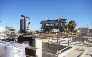
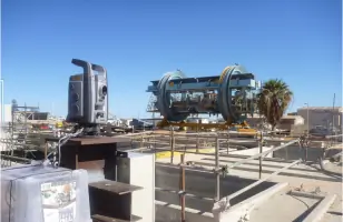
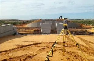
Our engineering surveys provide setting-out for roads, drainage systems, and infrastructure projects. We deliver as-built plans, machine guidance support, and structural monitoring for bridges and industrial facilities. Clients receive precise control networks and volume calculations to ensure construction accuracy and regulatory compliance.
Mining Surveying
We offer mineral claim pegging, tenement surveys, and exploration grid setup for mining operations. Our services include pit layout design, borefield mapping, and compliance reporting for regulatory bodies. Clients utilise our UAV and GPS technology for efficient site monitoring and stockpile volume calculations.
Town Planning
Our town planning services cover subdivision design, rezoning applications, and development approvals. We manage statutory processes from concept planning to project handover, coordinating with government agencies and contractors. Clients receive strategic advice on land capability and infrastructure requirements for residential and commercial projects.
Aerial Photography
Using UAV technology, we capture aerial data for topographic mapping, stockpile monitoring, and site progress tracking. Our drone surveys provide safe access to restricted areas and support 3D modeling for mining and construction projects. Clients benefit from rapid data collection and high-resolution imagery for decision-making.
People
Peter Hille
Founder
Founded the Geraldton practice in 1956, establishing its reputation for surveying excellence across regional Western Australia.
Gerry Thompson
Founder
Joined the practice in 1965, contributing to its growth as a trusted surveying and town planning authority in the Midwest region.
Edrick Delfos
Former Partner
Served as partner from 1987-2023, expanding the firm's capabilities in engineering and mining surveying projects.
Wayne Watters
Partner
Engineering Surveyor since 1996 and partner since 2007, specialising in infrastructure and construction surveying solutions.
Leigh Coaker
Partner
Licensed and Registered Mine Surveyor since 2006, became partner in 2023 with expertise in resource sector projects.
Questions
What surveying services do you offer?
We provide cadastral, engineering, mining, and aerial surveying services, along with town planning and GIS database management.
Are you accredited for quality and safety?
Yes, we hold ISO 9001:2015 for quality management and ISO 45001:2018 for occupational health and safety.
Which areas do you service?
We operate from Geraldton across the Midwest, Murchison, and South Pilbara regions, with nationwide capability.
How do you handle mining survey projects?
We use GPS and UAV technology for tenement surveys, exploration grids, and stockpile volume calculations with regulatory compliance.
Can you assist with subdivision approvals?
Yes, we manage rezoning applications, design plans, and statutory processes for urban and rural subdivisions.