
Business Details
Your Trusted Land Surveyors in Adelaide
Mosel Surveyors is a professional land surveying organisation with over 70 years of combined experience delivering tailored land solutions to individuals, corporations, and government clients across Adelaide and regional South Australia. Our team of licensed surveyors, subdivision specialists, and project managers pride themselves on providing innovative, client-focused services for projects ranging from boundary disputes to large-scale infrastructure developments. We maintain strong relationships with local councils and government agencies to streamline processes, while our investment in drone technology and GIS databases ensures precision in cadastral, topographic, and construction surveys.With a commitment to integrity, safety, and professional development, we handle all aspects of property subdivision, boundary identification, and civil construction projects, ensuring compliance with legal standards and client-specific requirements.
Services
Land Subdivision
Boundary Surveys
Project Design
Civil Construction
Government Projects
Drones Mapping
Easement Creation
Topographic Surveys
Mining Surveys
GIS Database
Highlights and features
- We offer over 70 years of combined experience in land surveying across South Australia
- Our licensed surveyors hold annual endorsements from the South Australian Board of Surveyors
- We maintain strong partnerships with local councils and government agencies
- We utilise advanced drone and scanning technology for precise data collection
- Our team specialises in both small subdivisions and large-scale infrastructure projects
Associations and certifications
- South Australian Board of Surveyors
Services
Land Subdivision
Mosel Surveyors specialise in managing complete land subdivision processes for urban and regional properties. We handle planning applications, boundary pegging, certified survey plans, and Land Titles Office submissions. Our team liaises with councils and conveyancers to ensure compliance with legal requirements while delivering tailored solutions for projects ranging from single allotment splits to large-scale developments.
Boundary Surveys
Our licensed surveyors conduct precise boundary identification and realignment services for residential and commercial properties. We provide boundary pegging, succession planning adjustments, and dispute resolution support. Using advanced technology, we ensure accurate legal documentation of property lines while maintaining compliance with South Australian cadastral standards.
Civil Construction
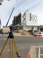
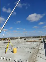
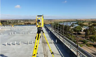
We deliver comprehensive surveying services for civil infrastructure projects including roads, stormwater systems, and commercial buildings. Our services cover set-out control, as-built surveys, and earthworks volume calculations. The team utilises GPS and laser scanning technology to ensure precision in projects ranging from local roads to industrial developments.
Government Projects
Mosel Surveyors maintain long-standing relationships with South Australian councils and government agencies. We specialise in public land transactions, road closures under the Roads Opening and Closing Act, and infrastructure upgrades. Our expertise includes cemetery GIS mapping, waste management volume calculations, and compliance with EPA guidelines for land development projects.
Drones Mapping
We employ advanced drone technology for geo-referenced aerial mapping and 3D scanning. This technology supports accurate topographic surveys, stockpile volume calculations, and infrastructure monitoring. Our drone services enhance efficiency and data precision for mining operations, property developments, and large-scale construction projects across South Australia.
People
Michael Liebelt
Director / Licensed Surveyor
With over 20 years mentoring licensed surveyors, Michael specialises in major land divisions and infrastructure projects. He chairs the Surveyors Board of South Australia and maintains long-term developer relationships spanning 20-30 years.
Jesse Phillips
Managing Director / Surveyor
A Murraylands local with 20+ years' experience, Jesse focuses on civil construction and regional surveying. He manages the drone program and trains surveyors in Murray Bridge while maintaining strong local stakeholder relationships.
Jesse Evans
Senior Licensed Surveyor
With 15+ years at Mosel, Jesse specialises in road closure projects and subdivision planning. He supervises team members and provides expert consultation on local government infrastructure developments across South Australia.
David Jericho
Senior Licensed Surveyor
A licensed surveyor since 1993, David has 20+ years' experience in boundary engineering and large-scale control surveys. He provides planning expertise for major subdivisions and trains team members in advanced surveying techniques.
Questions
What land surveying services do you offer?
We provide land subdivisions, boundary surveys, topographic mapping, civil construction set-out, government project support, and drone-based aerial surveys across South Australia.
How experienced are your surveyors?
Our team holds over 70 years combined experience with licensed surveyors maintaining annual endorsements from the South Australian Board of Surveyors.
Do you work with government agencies?
Yes, we collaborate with local councils and government bodies on road closures, public land transactions, infrastructure upgrades, and compliance projects.
Can you handle large-scale developments?
We manage projects from small subdivisions to major developments including retirement villages, marinas, and 50+ allotment subdivisions with full process oversight.
What technology do you use?
We utilise drones, GPS, laser scanning, and GIS databases to ensure precision in boundary mapping, volume calculations, and infrastructure monitoring.
How do you resolve boundary disputes?
Our licensed surveyors conduct precise boundary identification surveys, pegging, and legal documentation to resolve property line conflicts efficiently.