
Business Details
21 Years
experience
Expert Surveying Services in Nowra
Established over two decades ago, Leslie & Thompson has become a trusted name in surveying and land mapping services across the Shoalhaven region. Our team of registered surveyors combines advanced technology, including laser and GPS instruments, with a deep understanding of local geography to deliver precise and efficient results. With offices in Nowra and Vincentia, we serve clients from Batemans Bay to Wollongong, offering tailored solutions for residential, commercial, and large-scale infrastructure projects. Our commitment to continuous professional development ensures we remain at the forefront of industry advancements, providing clients with accurate data and comprehensive documentation.We pride ourselves on personalized service, ensuring every project is completed promptly with minimal disruption to clients. From boundary identification to subdivision planning, our expertise supports architects, engineers, and homeowners in achieving their development goals. Our computerised database of regional boundaries enhances efficiency, allowing rapid turnaround for surveys and mapping tasks. By maintaining state-of-the-art equipment and fostering a culture of excellence, we consistently meet the evolving needs of our clients while upholding the highest standards of professionalism.
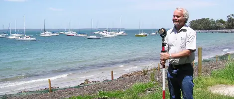
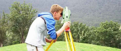
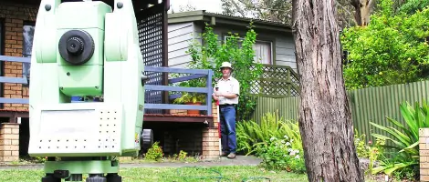
Services
Residential Surveying
Subdivisions
Engineering Surveys
Large Area Mapping
Strata Title Subdivisions
Site Surveys
House Construction Surveys
Identification Surveys
Details
- Year established: 2005
Highlights and features
- We utilise state-of-the-art laser and GPS surveying equipment for unmatched accuracy.
- Our team includes registered surveyors with over 20 years of regional experience.
- We provide tailored solutions for residential, engineering, and large-scale projects.
- Our computerised boundary database ensures rapid and precise survey results.
- We offer comprehensive support from initial consultation to final documentation.
Services
Residential Surveying
We provide detailed residential surveys for property buyers, homeowners, and architects. Our services include boundary identification, site analysis for renovations, and preparation of CAD-compatible plans. Using remote measurement technology, we assess adjoining properties without intrusion, ensuring accurate data for design and compliance purposes.
Subdivisions
Our subdivision services cover feasibility assessments, development applications, and final plan preparation. We manage council lodgments, coordinate specialist reports, and ensure compliance with local regulations. From initial design to final pegging, we streamline the subdivision process for residential and commercial developments.
Engineering Surveys
We deliver precise terrain data for engineering projects in AutoCAD 2D/3D formats. Our surveys support infrastructure planning, construction accuracy, and design compatibility. This service ensures engineers receive reliable data to initiate projects efficiently and meet technical specifications.
Large Area Mapping
Using GPS and aerial photography, we map extensive land plots for infrastructure projects. This service provides comprehensive spatial data, enabling accurate planning and execution of large-scale developments across diverse terrains.
Identification Surveys
Our identification surveys verify property boundaries and compliance with council regulations. This service prevents encroachments, confirms land markers, and supports informed decision-making for buyers, sellers, and developers.
People
Stuart Leslie
Principal Surveyor
With over 40 years of experience, Stuart Leslie leads our team as a registered surveyor. His expertise in land management and commitment to technological innovation ensures clients receive precise, forward-thinking solutions for complex surveying challenges.
Chris Woodlands
Surveyor
Chris Woodlands brings advanced spatial science skills to our team, specialising in data analysis and digital mapping. His technical proficiency ensures efficient delivery of accurate survey results for residential and commercial projects.
Matthew Sadler
Surveyor
Matthew Sadler contributes extensive field experience to our operations. His focus on client communication and attention to detail ensure seamless project execution from initial assessment to final documentation.
Terry Delahenty
Surveyor
Terry Delahenty combines technical expertise with local knowledge to deliver precise survey outcomes. His dedication to quality ensures clients receive reliable data tailored to their specific project requirements.
Daniel Robinson
Surveyor
Daniel Robinson applies his diploma in surveying to support diverse projects, focusing on accuracy and efficiency. His adaptability ensures timely completion of surveys for both small-scale and complex developments.
Questions
What areas do you service?
We cover the South Coast of NSW from Batemans Bay to Wollongong, including Shoalhaven, Eurobodalla, and Wingecarribee regions.
What survey types do you offer?
We provide residential, engineering, subdivision, strata title, large-area mapping, and identification surveys for diverse project needs.
How do you ensure survey accuracy?
We use advanced laser and GPS technology alongside a computerised boundary database to deliver precise, reliable results.
Can you assist with subdivision approvals?
Yes, we manage subdivision applications, prepare council documentation, and handle final plan lodgment for residential and commercial developments.
Do you work on large infrastructure projects?
Yes, we provide terrain data and mapping for major infrastructure projects using GPS and aerial photography technology.