
Business Details
22 Years
experience
Your Trusted Land Surveyors in Wagga Wagga & Albury
Established in 2004, Rivland Surveyors has become a trusted provider of land and construction surveying services across the Riverina region. Our multidisciplinary team specialises in cadastral land surveying and engineering surveying, delivering professional, reliable, and cost-effective solutions. With over two decades of combined experience, including Director Chris Sharp's 25+ years as a Registered Land Surveyor, we combine technical expertise with cutting-edge technology to meet diverse client needs. We serve infrastructure projects, construction companies, architects, and individual landowners, offering services from boundary redefinition to GPS machine guidance. Our 2010 acquisition of Les R. Young's land surveying business expanded our capabilities while maintaining rigorous quality assurance and health & safety standards.We prioritise client collaboration, handling complex government processes and electronic lodgements to simplify land development. Our work on high-profile projects, including a $65M Defence base, demonstrates our ability to manage large-scale, detail-intensive tasks efficiently. We invest continuously in staff training and equipment, including UAV technology for aerial surveys and volumetric analysis. Our commitment to precision extends to deformation monitoring, lease plans, and net lettable area surveys, ensuring compliance with NSW Land Registry Service requirements. With operations spanning Wagga Wagga, Albury, and surrounding regions, we remain dedicated to delivering surveying excellence that supports sustainable development and client success.

Services
Land Surveying
Construction Surveying
Boundary Redefinition
Subdivisions
Development Applications
Aerial Surveying
Monitoring Surveys
Lease Plans
Volume Surveys
Set-Out Surveys
Details
- Year established: 2004
Highlights and features
- We have over 25 years of experience in cadastral and construction surveying
- Our team uses advanced UAV and GPS technology for accurate measurements
- Director Chris Sharp is a Registered Land Surveyor with NSW Land Registry
- We handle complex government processes and electronic lodgements for clients
- Proven track record with large infrastructure projects like the $65M Defence base
What people say
Successful $65M Defence base surveying
12-month project completion
Registered Land Surveyor expertise
Advanced UAV technology use
Comprehensive service offering
Services
Land Surveying
Our land surveying services provide precise boundary definitions and legal documentation for property development. We conduct boundary redefinition, subdivisions, and consolidation plans to meet NSW Land Registry requirements. Our registered surveyors ensure compliance with all legislative standards while supporting clients through complex approval processes.
Construction Surveying
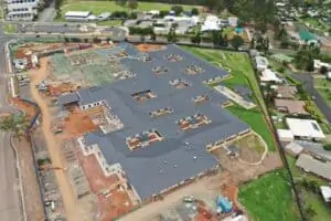
We deliver accurate set-out surveys and as-built documentation for construction projects. Our services include GPS machine guidance, deformation monitoring, and works-as-executed reports to ensure structural alignment with design specifications. This supports efficient earthworks, infrastructure development, and building construction.
Aerial Surveying
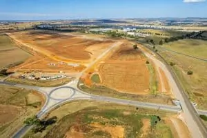
Using DJI Phantom 4 RTK UAV technology, we capture detailed topographic data for inaccessible areas. Our aerial surveys support volumetric calculations, terrain analysis, and infrastructure planning with high-resolution imaging processed through Pix4D software for accurate deliverables.
Development Applications
We prepare comprehensive development applications including detail surveys, sewer/stormwater designs, and flood plans. Our team handles electronic lodgement with local councils and NSW Land Registry to streamline approval processes for residential and commercial subdivisions.
Lease Plans
Our lease plans provide accurate net lettable area calculations for commercial properties. We prepare registered survey plans to define lease boundaries, preventing disputes while ensuring compliance with legal requirements for retail, industrial, and office spaces.
People
Chris Sharp
Director
With over 25 years' experience, Chris is a Registered Land Surveyor specialising in land development. He leads surveying operations and client relationships across NSW.
Questions
What areas do Rivland Surveyors service?
We operate across the Riverina region including Wagga Wagga, Albury, Griffith, and surrounding areas.
Are your surveyors registered professionals?
Yes, our Director Chris Sharp is a Registered Land Surveyor with NSW Land Registry Service.
What technology do you use for surveys?
We use UAV drones, GPS machine guidance, and 12d software for accurate surveying and design.
Can you handle subdivision approval processes?
Yes, we manage all stages including development applications and electronic lodgement with LRS.
Do you work on large infrastructure projects?
Yes, we've completed surveying for a $65M Defence base and similar major developments.