
Business Details
50+ Years
experience
Trusted Surveying & Town Planning Services in Sydney
Project Surveyors has been a trusted name in surveying and town planning since 1971, delivering precise and reliable services across Sydney and Regional NSW. Our team of award-winning experts combines decades of experience with cutting-edge technology, including 3D laser scanning and BIM solutions, to provide tailored project outcomes. As an ISO 9001-certified firm, we prioritise quality, accuracy, and client satisfaction, ensuring projects meet regulatory standards and deadlines.Our commitment to innovation and hands-on expertise has earned long-term trust from developers, property owners, and managers. We specialise in land surveying, town planning, and expert witness services, supporting clients from feasibility studies through to project completion with unmatched professionalism.


Services
Land Surveying
Town Planning
3D Laser Scanning
BIM/GIS Services
Expert Witness
Subdivision Services
Boundary Surveys
Topographic Mapping
Heritage Documentation
Clash Detection
Details
- Year established: 1971
Highlights and features
- We offer over 50 years of experience in surveying and town planning.
- Our team utilises cutting-edge 3D laser scanning and BIM technology.
- ISO 9001 certification ensures rigorous quality management standards.
- We provide tailored solutions for complex development and legal projects.
- Prompt turnaround times with a focus on client satisfaction and compliance.
Associations and certifications
- ISO 9001
What people say
Best quality survey
Top service
Quick response
Highly recommend
Fantastic knowledge
Services
Land Surveying
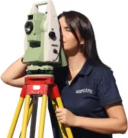
Project Surveyors provides comprehensive land surveying services, including boundary delineation, topographic mapping, and construction set-out. Our use of GNSS, robotic total stations, and laser scanners ensures millimetre-level accuracy for property transactions, dispute resolution, and infrastructure projects. With decades of experience, we deliver legally compliant data to support development planning and regulatory approvals.
Town Planning
Our town planning services guide clients through zoning regulations, development applications, and environmental assessments. We specialise in preparing planning reports, addressing council requirements, and resolving objections to secure approvals. With expertise in NSW planning laws, we ensure projects align with statutory frameworks while balancing community and environmental needs for residential, commercial, and industrial developments.
3D Laser Scanning
Using high-definition laser scanning, we capture detailed 3D data for heritage sites, infrastructure, and industrial facilities. This technology enables precise as-built documentation, clash detection, and volumetric analysis without physical contact. Our point cloud models support design validation, asset management, and renovation projects, reducing site revisits and accelerating decision-making for construction and engineering teams.
BIM/GIS Integration
We create BIM-ready models and GIS datasets to enhance project coordination and spatial analysis. Our Revit and CAD expertise ensures seamless integration of survey data into digital workflows, supporting clash detection, virtual reality visualisations, and lifecycle management. These tools improve collaboration across architects, engineers, and contractors, optimising design accuracy and reducing construction risks.
Expert Witness
Our expert witnesses provide impartial surveying evidence for boundary disputes, easement interpretations, and property litigation. With deep knowledge of NSW land law, we prepare defensible reports and court testimony to resolve conflicts over subdivisions, encroachments, and development compliance. Our professionals maintain strict impartiality, adhering to legal standards while clarifying technical issues for judicial outcomes.
People
Jonathan Saxon
Managing Director
With a Bachelor of Surveying and a Master of Management, Jonathan leads Project Surveyorss development and land titling divisions. His expertise spans 25+ years in NSW surveying and planning, ensuring strategic growth and technical excellence.
Nathan Milligan
Business Unit Manager - Spatial Information Capture
Nathan manages our 3D scanning and digital documentation projects. A registered surveyor with a BEng from UNSW, he specialises in integrating advanced technologies like LiDAR and BIM for complex infrastructure and heritage sites.
Anna Paterak
Business Unit Manager - Surveying
Anna oversees survey operations with a focus on precision and client needs. Holding a Master of Surveying in GIS, she ensures technical standards are met across boundary, construction, and cadastral surveys.
Ashley Saxon
Business Unit Manager - Town Planning
Ashley leads our town planning team, guiding clients through development applications and regulatory compliance. Her postgraduate urban management degree supports strategic solutions for residential and commercial projects across NSW.
Peter Bellingham
Business Unit Manager - BIM Management
Peter directs BIM implementation, leveraging his CAD and construction background to align digital models with survey data. His work ensures seamless integration for infrastructure and building projects.
Questions
What services does Clement & Reid offer?
We provide land surveying, town planning, 3D laser scanning, BIM/GIS integration, expert witness testimony, and subdivision services tailored to Sydney and NSW projects.
How does Clement & Reid ensure service quality?
As ISO 9001-certified professionals, we combine hands-on owner management with advanced technology to maintain rigorous quality control and client satisfaction.
What areas do you serve?
We operate across Greater Sydney and Regional NSW, supporting clients in urban, coastal, and rural developments.
Can you handle complex legal survey disputes?
Yes, our expert witnesses specialise in boundary disputes, easement interpretations, and court-compliant testimony for property and development cases.
Do you use modern surveying technology?
We employ GNSS, robotic total stations, terrestrial laser scanning, and BIM software to ensure precision and efficiency for all projects.
How do you support project timelines?
Our proactive approach and rapid turnaround for surveys and planning approvals ensure projects meet deadlines without compromising accuracy.