
Business Details
32 Years
experience
Expert Surveying Services in Byron Bay
Established over 30 years ago, Byron Bay Surveying has grown into a leading surveying firm in the Northern Rivers region of New South Wales. Our team of seasoned professionals combines extensive industry experience with cutting-edge technology to deliver precise and reliable surveying solutions for residential, commercial, and government projects. We pride ourselves on our commitment to accuracy, transparency, and client satisfaction, ensuring every project is approached with the utmost professionalism. Our services span property surveys, construction setout, land development, and infrastructure assessments, supported by innovative techniques like laser scanning and drone mapping. With offices in Byron Bay and Alstonville, we serve clients across New South Wales and Queensland, contributing to the growth and development of local communities.Our values of precision, clear communication, and safety underpin every task, from boundary definition to complex urban planning. We work closely with developers, councils, architects, and government bodies to provide data-driven insights that inform critical decisions. Our dedication to continuous learning ensures we remain at the forefront of industry advancements, offering clients the latest tools and methodologies. Whether managing small residential projects or large-scale infrastructure surveys, we prioritize client needs, delivering tailored solutions that meet exacting standards. This unwavering focus on quality and service has earned us a reputation as one of the region's most trusted surveying firms.
Services
Property Surveys
Construction Surveys
Land Development
Aerial Surveys
Infrastructure Surveys
Boundary Definition
Measured Building Surveys
Monitoring Services
Details
- Year established: 1994
Highlights and features
- We offer over 30 years of combined experience in land surveying across Northern NSW.
- Our team utilizes advanced 3D technology and laser scanning for precision results.
- We provide tailored solutions for residential, commercial, and government projects.
- Our local expertise extends to regional councils and cross-state developments.
- We maintain rigorous safety standards and transparent client communication.
Services
Property Surveys
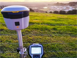
We conduct comprehensive property surveys to define boundaries, identify easements, and verify title accuracy. Our services ensure legal compliance and clarity for landowners, developers, and councils. Utilizing advanced tools like laser scanning and GPS, we deliver precise data to support property transactions, dispute resolution, and development planning.
Construction Surveys
Our construction surveying services ensure accurate project execution from small residential builds to large infrastructure. We provide setout for buildings, pipelines, and industrial facilities, using robotic total stations and 3D modeling. This guarantees alignment with design specifications and regulatory standards, minimizing costly errors during construction phases.
Land Development
We facilitate strata and community title subdivisions, including boundary redefinition and easement establishment. Our work supports urban planning, rural development, and commercial projects. We prepare detailed plans for council approval and coordinate with stakeholders to ensure compliance with zoning regulations and infrastructure requirements.
Aerial Surveys
Using drones and LiDAR technology, we capture high-resolution topographic data for large-scale projects. This method enables efficient mapping of challenging terrains, flood-affected areas, and infrastructure corridors. Clients receive detailed 3D models and orthophoto maps to inform design, monitoring, and environmental assessments.
Infrastructure Surveys
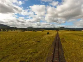
We assess and document critical infrastructure including sewer systems, rail corridors, and drainage networks. Our surveys employ laser scanning to map underground utilities and above-ground assets, ensuring safety and accuracy. These surveys support maintenance planning, capacity analysis, and compliance with council requirements for public infrastructure.
People
Bill Nagel
Director
With over 30 years of experience in land surveying, Bill Nagel leads Byron Bay Surveying's operations. His expertise spans boundary definition, construction setout, and infrastructure assessments. Bill prioritizes client collaboration and technological innovation to deliver precise, actionable surveying solutions.
Lucas Flumm
Surveyor
Lucas Flumm brings extensive industry knowledge to Byron Bay Surveying, specializing in land development and aerial mapping. With a focus on precision and client communication, he contributes to complex projects including council infrastructure assessments and urban planning initiatives across Northern NSW.
Questions
What areas do you service?
We cover the Northern Rivers region of New South Wales and the Gold Coast in Queensland.
How long does a survey report take?
Reports are typically delivered within a week of fieldwork, depending on complexity.
Do you handle small boundary jobs?
Yes, we undertake projects of all sizes, including minor boundary assessments.
Can I locate boundary pegs myself?
You may find pegs in recently surveyed properties, but professional verification is recommended.
Do you use GPS for surveys?
We use GPS alongside traditional methods, selecting the most appropriate tools for each project.
How are survey fees determined?
Costs depend on project size, complexity, and required deliverables. Contact us for a quote.